Earth’s thermal infrared spectrum
“Most satellite sensors can’t measure ozone at such altitudes, where it’s hidden by the ozone layer, extending 20 to 50 km above Earth’s surface. This layer contains 90% of atmospheric ozone and shields us from solar ultraviolet radiation”
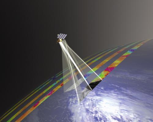
So how did IASI manage this feat? “IASI (launched in 2006 on the European MetOp-A satellite) precisely measures Earth’s thermal infrared spectrum, which varies according to the gases present in the atmosphere.”
But these measurements only provide raw data. Using sophisticated methods, scientists at the LISA* inter-university laboratory for the study of atmospheric systems have succeeded in isolating the signature of ozone at the altitudes where it lies. Their results were recently published in Geophysical Research Letters.
Better forecasting of air quality
IASI data complement ground measurements, acquired mainly in large cities, which cannot provide a uniform, global picture of ozone and measure more especially pollution near the surface, such as car and industry emissions.
As well as providing information about the lower troposphere, IASI will also measure pollution at higher altitude (approx. 5 to 12 km) where elements mix on a wider, intercontinental scale.
* Laboratoire Inter-universitaire des Systèmes Atmosphériques, a joint research unit of Université Paris 7 (Paris Jussieu) and Université Paris 12 (Créteil).